
Thanks to all who voted!
Find out which door was crowned Door of the Week. The theme was the #SFBay Area Doors.
How did your fave do? Open the post & see...


Thanks to all who voted!
Find out which door was crowned Door of the Week. The theme was the #SFBay Area Doors.
How did your fave do? Open the post & see...
Will it be Team #SanFrancisco that takes the #door of the week title this time? The theme is #SFBay #doors. #California #USA #Photography
Posted into Doors, Glorious doors! @doors-glorious-doors-sidewalksafari
Will it be Team #SiliconValley that takes the #door of the week title this time? The theme is #SFBay #doors. #California #USA #Photography
Posted into Doors OF THE WORLD @doors-of-the-world-salvomic
Will it be Team #SanJose that takes the #door of the week title this time? The theme is #SFBay #doors. #California #USA #Photography
Posted into Doors, Glorious doors! @doors-glorious-doors-sidewalksafari
Across the Bay to the Contra Costa--the East Bay cities #Petrofuture . Melted ice caps on a vintage Shell gas station map.
Higher-res images:
https://conspiracyofcartographers.com/petrofuturegallery/

Another favorite…the #Petrofuture map of San Francisco. Melted ice caps on a vintage Chevron gas station map.
Higher-res images:
https://conspiracyofcartographers.com/petrofuturegallery/

A reminder of what the Bay looked like before environmental regulation—open dumping of industrial waste, raw sewage, and fuel, and constant oil spills.
Before EPA and laws like the Clean Water Act, America's waters were choked with pollution. Ohio's Cuyahoga River, which became a symbol of environmental degradation in the 60s, was so polluted that it repeatedly caught fire.
Today, it's estimated that the #CleanWaterAct alone prevents 700 *billion* pounds of toxic pollution from entering US waters every single year.
We MUST defend these vital laws and institutions.
#EPA #bayarea #sanfranciscobay #SFBay #environment #waterpollution
Photos courtesy of EPA's historic archive


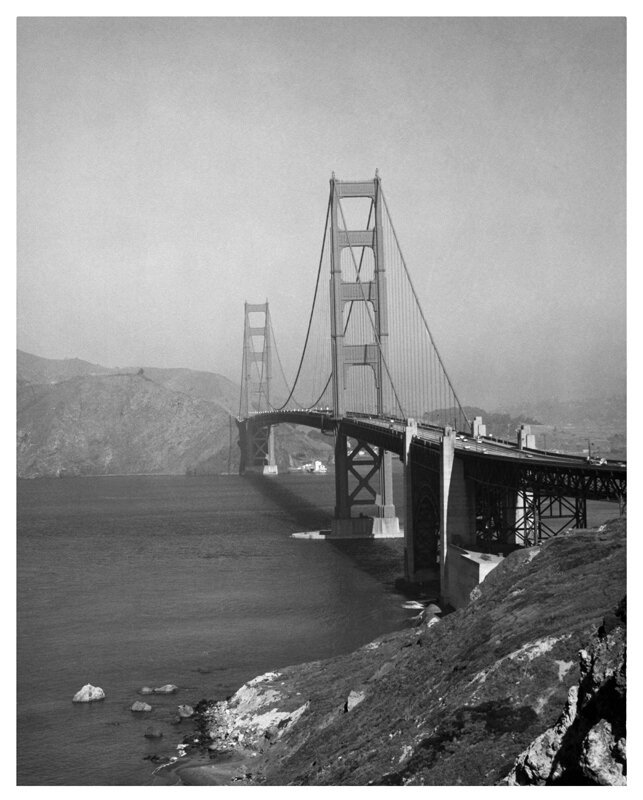
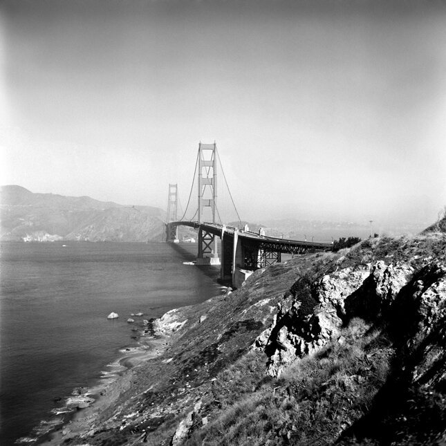
If I thought it was allowed, I would have asked the captain if we could sail the entire length of the bridge so I could capture its underbelly in all its glory.

Does anyone know what happened at Glass Key Photo? I got an email with a go fund me link to help them because of a smash and grab but I did not see anything on the local news. Of course I did not click the link because scammers work overtime. Still, I would like to know if it's true. #SFBay #SanFrancisco
FLOOD WATCH,
IN EFFECT THRU SUNDAY EVE (2/16)
Flooding caused by excessive rainfall continues to be possible.
WHERE: Entire North SF Bay. #California
IMPACTS: Excessive runoff may result in flooding of rivers, creeks, streams & low-lying & flood-prone locations. Creeks & streams may rise out of their banks. Flooding may occur in poor drainage & urban areas. Low-water crossings may be flooded. Area creeks & streams are running high & could flood with more heavy rain & continuous runoff.
*ADDITIONAL DETAILS:
- Excessive runoff & elevated levels on area rivers, streams & creeks as well as near-saturated soil will resulting in an increased flood potential as the Atmospheric River brings moderate to heavy rain to the region.
- http://www.weather.gov/safety/flood
PRECAUTIONARY/PREPAREDNESS ACTIONS: Monitor later forecasts & be alert for possible Flood Warnings. Those living in areas prone to flooding should be prepared to take action.
SF dumps millions of gallons of sewage during big storms -- not cool, guys!! 

 ️
️
As our executive director Sejal Choksi-Chugh told KQED, discharge areas are sacrifice zones where the city has nowhere else to release polluted water.
"They're not allowed to be discharging this much bacteria and pollution into the Bay, yet they are doing it."
https://www.kqed.org/science/1996145/sf-dumps-millions-of-gallons-of-sewage-during-big-storms-surfers-say-that-needs-to-stop #sf #sanfrancisco #sfpuc #sewage #sewagepollution #sfbay #sanfraciscobay
FLOOD WATCH,
FROM 10 PM THIS EVE (2/12) THRU SATURDAY EVE
Flooding caused by excessive rainfall possible.
WHERE: Entire North SF Bay. #California
IMPACTS: Excessive runoff may result in flooding of rivers, creeks, streams & other low-lying locations. Creeks & streams may rise out of their banks. Flooding may occur in poor drainage & urban areas. Low-water crossings may be flooded. Area creeks & streams are elevated & could flood with more heavy rain.
ADDITIONAL DETAILS:
- Elevated levels on area rivers, streams & creeks as well as near-saturated soil will result in an increased flood potential as the next Atmospheric River brings moderate to heavy rain to the region beginning tonight & into Thursday.
- http://www.weather.gov/safety/flood
PRECAUTIONARY/PREPAREDNESS ACTIONS: Monitor later forecasts & be alert for possible Flood Warnings. Those living in areas prone to flooding should be prepared to take action if flooding develop.


San Carlos Air Traffic Control Team Resigns;
San Carlos Airport control tower set to go dark by end of week
#SFBay #SanCarlos #KSQL #SQL
#100DollarHamburger #PilotLife
#SmallAirport #FlyLocal
#FAA #AirController


#MutualAid #SFBay #SolanoCounty Share and step up, comrades.
bit.ly/TiffCareWeb
🎙💜🧿 or @MaskPartySF to help, or fill out Bit.ly/TiffCareWeb
Seeking people with strong COVID precautions.
Re-shares appreciated, thank you!")


 ️
️


 looking impossibly happy and goofy, with a big grin and his pink tongue showing, and yet he is also still very handsome? Behind him is the blue water of the bay, some old pilings in a line heading into the water, and the Richmond-San Rafael bridge in the background")