EO-Tools 2025.4.0 is out!
New in this release:
- Support for Sentinel-1C products!
- H-Alpha dual-pol decomposition from SLCs
Dive in: https://eo-tools.readthedocs.io
Code: https://github.com/odhondt/eo_tools
EO-Tools 2025.4.0 is out!
New in this release:
- Support for Sentinel-1C products!
- H-Alpha dual-pol decomposition from SLCs
Dive in: https://eo-tools.readthedocs.io
Code: https://github.com/odhondt/eo_tools
El poder i detall de les tècniques de teleobservació de la terra em flipa molt.
https://framapiaf.org/@tyldurd/114359605408260967
Here's a polarimetric color composite of a Sentinel-1C image processed with EO-Tools — shown both without and with terrain flattening. It's fascinating how much information is hidden by topography.
I'm thinking of adding compositing functions directly into the software. What do you think — would that be useful?
#ESA commissioned an impact assessment for our Night Watch project, check it out: https://space-economy.esa.int/documents/CCBE0DaUI85rBweWdm0OJKhQpLUMv4SdqfKx8Ovz.pdf
New preprint on @EuroGeosciences
EGUsphere: "Satellite-based estimation of contrail cirrus cloud radiative forcing derived through a Rapid Contrail-RF Estimation Approach" #RemoteSensing #EarthObservation #RadiativeForcing as part of the E-CONTRAIL project https://www.econtrail.com/
https://egusphere.copernicus.org/preprints/2025/egusphere-2025-697/
Data In Action: The 2022 Hunga-Tonga Hunga-Ha′Apai Eruption - Altimetry Data And Models Help Us Understand How A Volcanic Eruption Generated A Tsunami
--
https://podaac.jpl.nasa.gov/DataAction-2025-03-20-The-2022-Hunga-Tonga-Hunga-Haapai-eruption-Altimetry-data-and-models-help-us-understand-how-a-volcanic-eruption-generated-a-tsunami <-- shared technical article
--
https://doi.org/10.1038/s43247-024-01694-z <-- shared paper
--
https://podaac.jpl.nasa.gov/dataset/JASON_CS_S6A_L2_ALT_LR_RED_OST_NTC_F08 <-- shared NASA dataset - Sentinel-6A MF Jason-CS L2 P4 Altimeter Low Resolution (LR) NTC Reduced Ocean Surface Topography F08
--
#GIS #spatial #mapping #earthobservation #remotesensing #fedscience #tonga #HungaTonga #HungaHaApai #eruption #volcanic #volcano #Pacific #marine #geology #engineeringgeology #risk #hazard #satellite #altimetry #data #model #model #spatialanalysis #Tsunami #risk #hazard #monitoring #coast #coastal #naturalhazard #Sentinel #sealevel #warning #earlywarning
@nasa
A while back (around seven months ago) I posted an image of ISS (first image), but captured FROM ABOVE (higher orbit). This is the work of Aussie company HEO!
This type of work is really fascinating as things (like satellites) are all moving at high velocities up there (28,000 km/h) - so other things (like other satellites or space stations) zip past quickly. You would then need to 'de-zip' the object to make a crisp clear image.
Well, they've done it again.
This time, imaging the Chinese Space Station (second image) from a distance of 83 kilometres (resolution of 0.17 m/px)
This is really cool stuff. I promise.
BlackSky / HEO
Job - Alert
POSTDOC POSITION (F_M_X) - MULTI-SCALE LIDAR AND EUROPEAN BIOMASS MONITORING
Deadline: 2025-04-22
Location: Germany, Potsdam, Brandenburg
Canadian startup Wyvern operates a growing CubeSat constellation that generates hyperspectral satellite imagery and hosts an open data program. Mark Litwintschik has posted a detailed examination of Wyvern's open data feed and the array of tools he uses to do so:
The European Space Agency (ESA) operates a constellation of satellites known as the Copernicus Sentinels. Collectively the system generates terabytes of Earth Observation (EO) data daily. Copernicus Data Space Ecosystem (CDSE) is a free, public platform that provides access to Copernicus data and a range of analysis and visualization tools. A talk delivered at FOSDEM 2025 dives into the details:
Satellite Imagery You Can Play With
--
https://hackaday.com/2025/03/10/satellite-imagery-you-can-play-with/ <-- shared technical article
--
https://tech.marksblogg.com/satellogic-open-data-feed.html <-- shared ‘how to’ article
--
[this post should not be considered an endorsement of any product or service]
#GIS #spatial #mapping #Satellogic #EarthView #satellite #cubesat #NewSat #microsatellites #GDAL #python #DuckDB #H3 #JSON #Lindel #Parquet #remotesensing #earthobservation #Aleph #NORAD #location #howto #tutorial #code #coding #metadata #imagery
What would be your solution of choice to automatically and regularly check the availability and download public remote sensing data on your server? Like cron jobs but integrated in a #python software?
#EarthObservation #Geospatial
The compilation of observations from different ship campaigns can be tedious–but a solution is underway. By taking the example of the 2023 ARC cruise in the Atlantic, a team around Laura Köhler (@awi)& #MPI_scientist Julia Windmiller proposes a standardized approach for the management of ship-based data.
The package includes the data itself, a paper, a #GitHub repository & a #Python package! See https://mpimet.mpg.de/en/communication/detail-view-news-homepage/proposal-for-an-improved-handling-of-ship-based-data
#FAIRData #EarthObservation
Credit: D. Kępski
EO-Tools 2025.2.0 is out!
No new features this time, but several fixes and code improvements.
Breaking change: to make parameter names more consistent, several function calls have changed—check the version notes and API reference for details.
Full details: https://eo-tools.readthedocs.io/en/latest/
EO-Tools 2025.1.1 is out!
Users can now choose one of SRTM, ALOS-World3D, Copernicus 30m and 90m DEMs in both Sentinel-1 InSAR and SLC processors.
Applications for the OpenGeoHub EO-Council.nl summer school 2025 "Data Science for Earth Observation: Hands-on Training in Python, R and Julia" are closing on 18th of January 2025. If you are looking for training, hackathons and are eager to meet other young scholars in the field, come to Wageningen and learn from the leading European open source developers. URL: https://opengeohub.org/summer-school/summer-school-2025/
Previous summer schools are available via: https://av.tib.eu/publisher/OpenGeoHub_Foundation
#Geospatial #earthobservation #python
@eumetsat 's #meteosat12 is the first of a new generation of geostationary #weather satellites over Europe. Better spatial resolution, more spectral bands, overall a win for weather forecast and climate studies! #EarthObservation
#EarthObservation data can
• Capture #images
• Measure natural and human made #objects
• Delineate shorelines and measure soil #moisture content
• Assess #atmospheric conditions
• Measure #temperature and detect heat sources
• Classify land coverage and use
• Identify and differentiate species of #vegetation
• Identify the #chemicals present in land, water and atmosphere
• Classify human made #infrastructure
• Measure radio, microwave and ultraviolet #radiation
https://www.weforum.org/stories/2024/07/earth-observation-helps-protect-natural-ecosystems
C'est le seul passage maritime entre l'océan Atlantique et la mer Méditerranée : voici le détroit de Gibraltar observé par un satellite Sentinel-2 en décembre 2020.
Les grands fleuves qui alimentent la Méditerranée, comme le Nil ou le Rhône, ne suffisent pas à compenser son évaporation : c'est donc grâce à ce détroit que cette mer continue d'exister
Téléchargez l'image en HD sur https://phototheque.cnes.fr/cnes/media/86269
@CopernicusEU Sentinel data, 2020
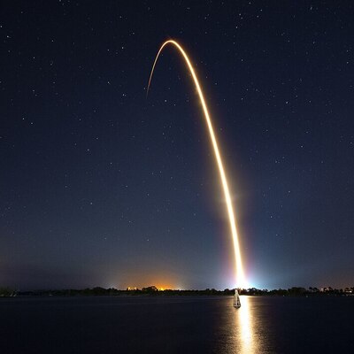
Découvrez en images l’incroyable aventure de Transat, notre 1er Ballon Stratosphérique Ouvert à traverser l’Atlantique ! En 3 jours et 17 heures, ce géant de 800 000 m³ a relié la Suède
au Canada
en transportant 8 instruments scientifiques pour étudier la chimie de l’atmosphère. https://www.youtube.com/watch?v=itxTZkj1DTE